

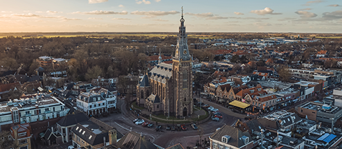
East-Flanders aquathermal potential map


.

Mapping the potential of all water bodies in the province of East Flanders? An ideal case for our aquathermal models! They were therefore optimally used in this study since in-depth results were required. The research focused namely not only on the potential of the sources themselves, but also on creating an optimal connection between the potential of aquathermal heating and the surrounding heat demand. A "classical" first-come-first-serve method was not used, but rather a distribution key that could deliver the available heat to the urban areas that would benefit most from aquathermal energy. In addition to aquathermal heating, the potential of sewage heat was also mapped in collaboration with Aquafin and, like the water sources, connected to the urban areas in the province of East Flanders.
.
Mapping the potential of all water bodies in the province of East Flanders? An ideal case for our aquathermal models! They were therefore optimally used in this study since in-depth results were required. The research focused namely not only on the potential of the sources themselves, but also on creating an optimal connection between the potential of aquathermal heating and the surrounding heat demand. A "classical" first-come-first-serve method was not used, but rather a distribution key that could deliver the available heat to the urban areas that would benefit most from aquathermal energy. In addition to aquathermal heating, the potential of sewage heat was also mapped in collaboration with Aquafin and, like the water sources, connected to the urban areas in the province of East Flanders.
Potential delivered heat
3886 GWh/year
Squaresurface lakes
2400 km2
Kilometers rivers
398 km

In order to correctly determine the potential of the aquathermal sources (rivers and lakes) and sewage sources (wastewater treatment plant and sewage pipes) in East Flanders, dynamic simulations are required that take into account the aspects below:
- Results at the level of sources and urban areas: One can analyse the potential of the different sources themselves but it is also possible to look at the potential on the level of urban areas.
- Dynamic simulation with an optimal allocation key: One of the first conclusions from this study is that the potential of aquathermal and sewage energy is not unlimited. In other words, a choice must be made where the available but limited heat can go. As a result, an optimal allocation key was sought and used in the calculations. The allocation key gives priority to urban areas that do not have access to other heat sources, that have a high heat demand density and that are located close to an aquathermal or sewage source. This allows aquathermal and sewage energy to be used for cores that will benefit most from these technologies.
- Dynamic simulations over time: The potential of flowing water bodies (rivers and canals) has been analyzed over time since there is a strong variation in the available potential of these resources on an annual basis (based on volume of water in the watercourses, temperature of water, environmental conditions, etc.).
- Dynamic simulations in space: The potential of each flowing water body was also simulated geographically dynamically. A geographically dynamic simulation involves simulating the downstream impact between different locations. In other words, it takes into account how e.g. the cities of Geraardsbergen and Dendermonde affect each other thermally since they are both located on the Dender.
- Dynamic simulation with regeneration: Regeneration from the environment between the different heat demand locations has been taken into account. This is necessary since the sun, air and subsoil will ensure that the temperature drop caused by Geraardsbergen's heat demand will become less critical by the time the Dender arrives in Dendermonde.
More info on the method used can be consulted in the report of this study.
The in-depth results are clearly presented on an interactive map. The map was developed in collaboration with Nazka Mapps and is available through this weblink. The goal of making in-depth results available ensures that the resulting online aquathermal map can also be put to good use by different agencies. For example, aquathermal and sewage energy can be included as sources in policy choices for making heat demand in the province of East Flanders more sustainable. But also project specifically the tool can be used to find out whether aquathermal or sewage energy is an option for heating the building in the vicinity of a future or redevelopment project. The tool thus aims to inform about the potential of aquathermy and riothermy through in-depth analyses, so that these sources can be correctly assessed for project developments.

East-Flanders aquathermal potential map
If we make good arrangements, almost 40 percent of the heat demand near water can be met by aquathermal energy in the province of East-Flanders. That's up to 20 percent of the heat demand of the entire Province! Now we have a well-founded basis to do that matching in advance. I dare say we are once again taking the lead here. With aquathermal energy we are continuing the pioneering role of East-Flanders Energy Landscape.
:
.

.


Interested in an aquathermal installation? Read more on our approach on why an aquathermal system migh be interesting for your water body!
